Example of determining longitude and latitude from the Sun at noon
The history of determining longitude at sea is fascinating. In practice, it was solved by John Harrison, a Yorkshire carpenter. The chronometer he built was the first device capable of measuring time accurately enough on a rolling ship.
The simplest way to determine longitude is to measure the time of the Sun’s upper meridian transit. When the Sun is at its highest point above the horizon, it is directly above the ship’s longitude. At that moment, the projection point of the Sun on Earth is either directly north or directly south of us. If we know the current time in Greenwich and the time when the Sun was on the Greenwich meridian, we can calculate our longitude. As you read in the previous section, the Sun’s projection point moves 1 degree in 4 minutes along the equatorial plane, i.e. one longitude degree every 4 minutes.
The Earth’s orbit around the Sun is not a perfect circle but an ellipse.
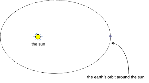
The Earth rotates around its axis in 23 hours, 56 minutes, and 4.091 seconds. In addition, the Earth moves along its orbit around the Sun, and therefore on average the Sun returns to the same meridian every 24 hours. On average. In practice, due to Earth’s elliptical orbit, this natural solar day can be 22 seconds shorter or 29 seconds longer.
You do not need to memorize the previous paragraph. It is only important to understand that the Sun is not always on the Greenwich meridian at exactly 12:00, but the time varies. Sometimes the Sun is at its highest at 11:58 and sometimes only at 12:02.
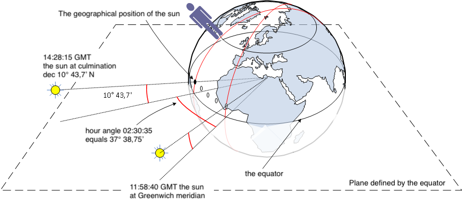
If you measure that the Sun is at its highest at 14:28:15 Greenwich Mean Time, what is your longitude?
From the Nautical Almanac you can see that today the Sun was at its highest in Greenwich at 11:58:40.
The difference in local noon times is 14:28:15 − 11:58:40 = 02 hours, 30 minutes, 35 seconds.
Since the Sun is overhead after local noon, we can assume we are west of Greenwich. From the section Relationship between hour angle and time we know the relationship between time and degrees. 02 hours, 30 minutes, 35 seconds corresponds to 37° 38.75’. Therefore, our position is on the meridian 37° 38.75’ west longitude.
At the same time, we measure that the Sun’s maximum altitude at noon was 70° 21.5’. What is our latitude?
From the Nautical Almanac we see that on this date the Sun’s declination is 10° 43.7’ N. The Sun is therefore a little over ten degrees north of the equatorial plane.
The situation is as follows.
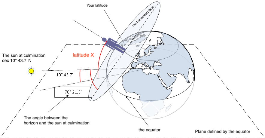
In a simpler diagram, the situation is this:
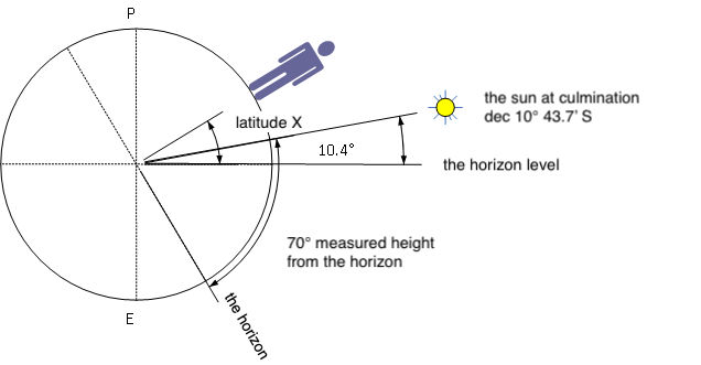
The angle between latitude and the horizon is 90°. The angle between the horizon and the equatorial plane is 70° 21.5’ − 10° 43.7’. Latitude + (angle between horizon and equatorial plane) = 90°.
Thus X + 70° 21.5’ − 10° 43.7’ = 90°. Solving this gives:
X = 90° − 70° 21.5’ + 10° 43.7’ = 19° 39.5’ + 10° 43.7’ = 30° 23.2’. Our position is therefore 30° 23.2’ north latitude, 37° 38.75’ west longitude.
C o n t e n t s
- Position fixing using stars
- The night sky
- The celestial sphere
- What you see at the North Pole as the Earth rotates
- How the night sky changes when traveling to the equator
- Effect of Earth’s rotation on the sky at the equator
- Celestial meridian, upper and lower culmination
- Change in star altitude at poles, equator, and between them
- Declination
- Example of determining latitude
- Hour angle, Greenwich Hour Angle (GHA)
- Aries, Greenwich of the celestial sphere
- Sidereal hour angle (SHA)
- Local hour angle (LHA)
- Relationship between hour angle and time
- Example of determining longitude and latitude from the Sun at noon
- Relationship between angles, degrees, and nautical miles on Earth
- Spherical position circle
- Azimuth
- True bearing to a star
- Nautical triangle
- Solving the nautical triangle (altitude calculation)
- Position fixing using Marcq Saint-Hilaire intercept method
- Star identification
- Details and practice
- Time
- Time difference (ΔT)
- Altitude measurement
- Example of position fixing
- Twilight
- Calculating twilight time
- Navigation Association exam
Hamburg VII 2026